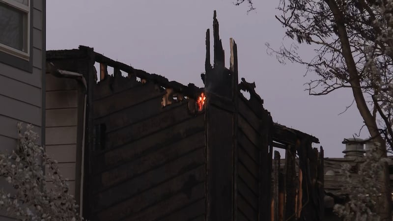
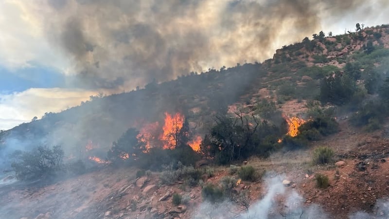
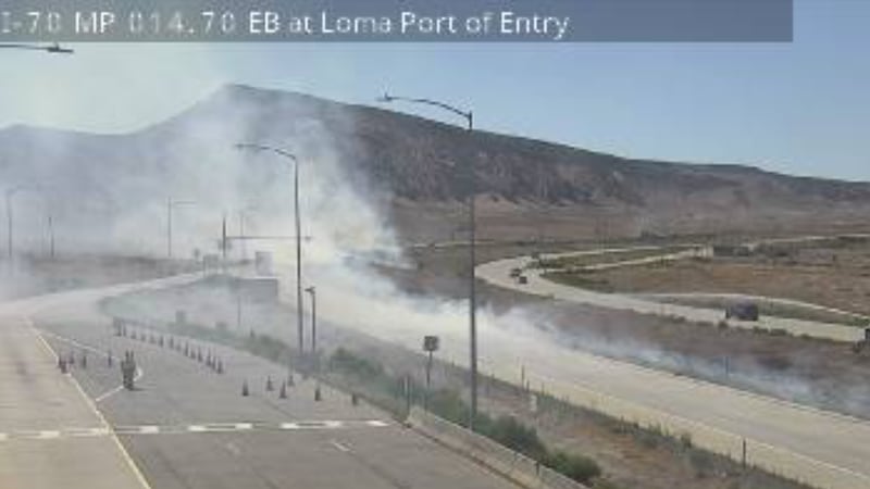
FIRST ALERT | Elevated Wildfire Danger, Clouds & Isolated Rain Chances This Weekend
GRAND JUNCTION, Colo. (KJCT) - Red flag warnings are in effect this afternoon, chances for showers and thunderstorms for Saturday and Sunday increasing the risk for new fires to start. Above normal temperatures, gusty, winds, and dry conditions next week. Critical fire, weather conditions look to continue.
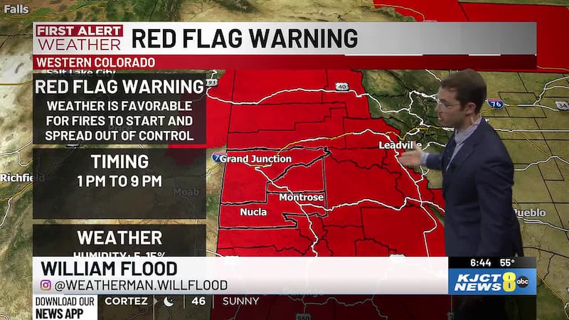
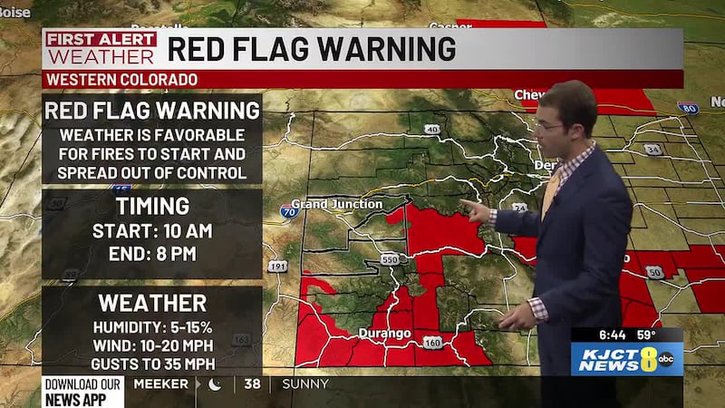
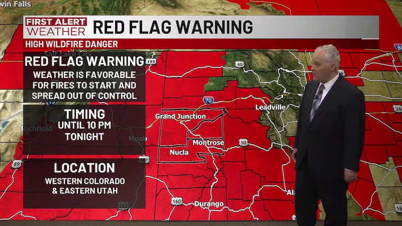
Red Flag Warning
Red flag warning goes into effect from 1 pm until 9 pm due to gusty winds, low relative, humidity and dry fuels. The majority of western slope is under this red flag warning spanning all regions west of the Medicine Bow Mountains, Front Range, Continental Divide, all the way down to the Sangre de Cristo Mountains. The forecasted weather is favorable for fires to start and spread out of control with winds ranging from 25 to 35 mph.
Sunny Friday
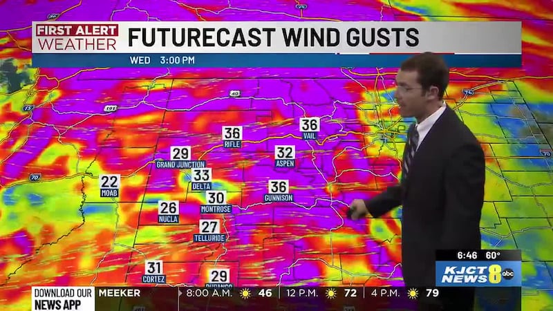
Sunny skies over Western slope this Friday with warmer daytime high temperatures than yesterday and an elevated wildfire risk. UV index of 11 meaning we have a 10 to 15 minute sunburn time so please wear sunscreen and or limit your time directly exposed to the sun. Wind gusts are expected to range from 25 to 35 mph with potential isolated gusts up to 40 mph. Daytime high temperatures ranging from 93° in Cortez and Montrose, 95° in Grand Junction, and 96° in Delta. Overnight to morning low temperatures will rain from 53° in Cortez, 56° in Montrose, 57° in Delta, and 60° in Grand Junction.
More Clouds for Saturday
To start your weekend Saturday will be mostly clear for the morning hours, but by noon, we’ll see those clouds increase for partly cloudy skies over the majority of western slope. Grand Junction looks to hold off on the clouds until around two or 3 PM. Wind gusts are expected to range from 15 to 25 mph with gusts up to 30 mph near the Delta area. Daytime high temperatures will be warmer again ranging from 92° in Montrose, 93° in Cortez, and 97° in Delta in Grand Junction. Overnight to mourning low temperatures will range from 54° in Cortez, 57° in Montrose, 60° in Delta, and 63° in Grand Junction.
Isolated Rain & Thunderstorms Sunday Afternoon
Partly cloudy skies with isolated shower chances for Sunday. Rain showers and possible thunderstorms will start to develop mostly over the higher elevations afternoon, most of the isolated showers and possible thunderstorms, increase our wildfire risk due to lightning. These showers and thunderstorms will mostly remain south of I 70 and prioritize the higher elevations. Wind gusts are going to range from 20 to 30 mph. Daytime high temperatures will be slightly cooler ranging from 89° in Montrose, 90° in Cortez, 93° in Delta and Grand Junction.
Next Week’s Hot, Dry, & Windy Weather Outlook
Monday, Tuesday, and Wednesday of next week will be sunny skies with temperatures continuing to climb. Monday is forecasted to have daytime high temperatures ranging from high 80s to mid 90s. Tuesday those daytime high temperatures increase to forecasted low to mid 90s. Wednesday is forecasted to have high temperatures ranging from mid 90s to 100° in Delta and Grand Junction. Wednesday also looks currently to have the highest elevated wildfire danger for the beginning half of next week with potential wind gusts of 20 to 35 mph with potential wind gusts for Delta and Cortez reaching out to 40 mph.