FIRST ALERT | Rain & heavy rain at times with flash flooding risk especially in the Southwest
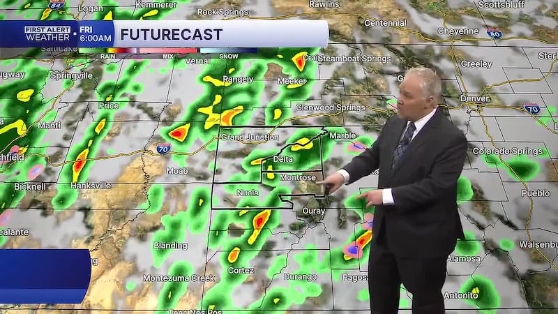
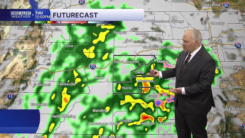
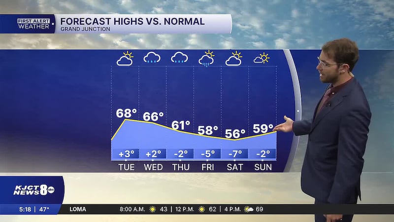
GRAND JUNCTION, Colo. (KJCT) - Showers and rain with the risk of flash flooding until Friday afternoon. Cooling temperatures dip below normal through the weekend.
Weather Alert: Flood watch
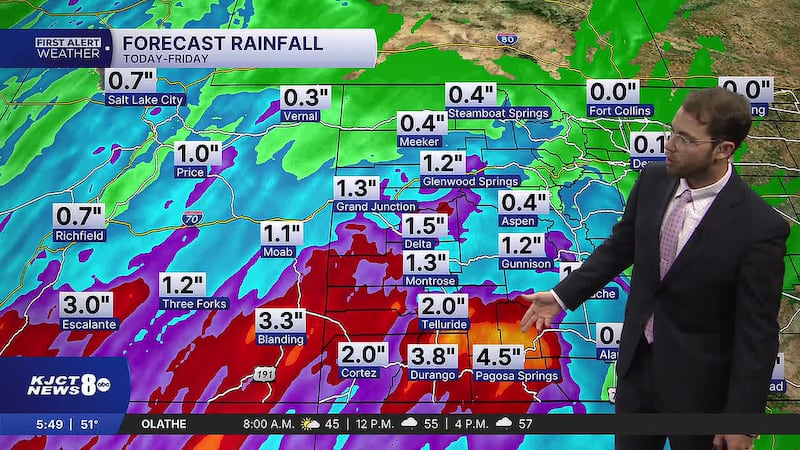
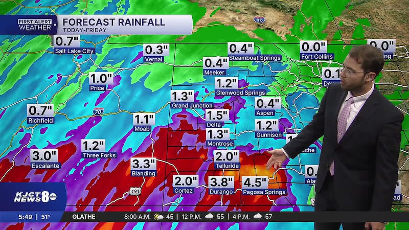
A Flood Watch is in effect for southwest Colorado until noon Friday. There will be some thunderstorms that drop heavy rain that can lead to flash flooding, especially around creeks, streams, rivers, canyons, and burn scars. Some storms can have rainfall rates of over an inch per hour. Be weather aware and have ways to receive weather alerts. Don’t go through flood waters with your car, instead turn around and don’t drown!
Next 24 hours
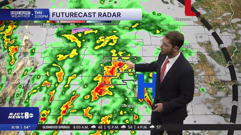
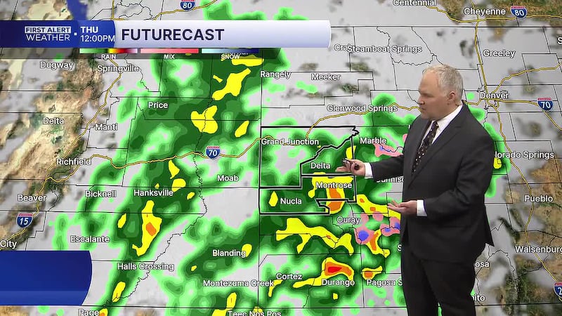
Today, occasional rain and periods of heavy rain for southwest Colorado with mostly cloudy conditions. Slight and moderate excessive rainfall outlook increases the risk for localized flash flooding, especially in flooding vulnerable areas in southwestern Colorado. Increased wind gusts near the Four Corners will range up to 30-40 mph, unsecured objects could be blown around. Snow Daytime high temperatures will range from high 50s to low 60s. Overnight to morning low temperatures will range mid 40s to low 50s.
Morning showers Friday
Friday, scattered showers and thunderstorms in the morning with clearing skies by the afternoon and evening. Snow levels will drop from over 12,000 feet to 10,000 feet. Daytime high temperatures will range around the low 60s. Overnight to morning low temperatures will range mid 40s to low 50s.
More occasional showers Saturday
Saturday, isolated showers increasing to scattered showers by the afternoon. Snow levels will drop from 10,000 feet to 9,000 feet. Daytime high temperatures will range around high 50s to low 60s. Overnight to morning low temperatures will range mid 40s to low 50s.