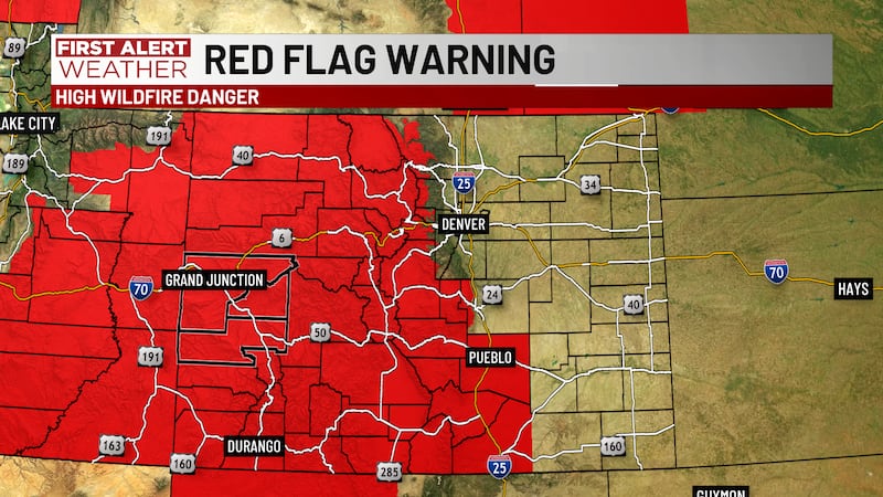
FIRST ALERT | Fire Weather Watch issued for Saturday
GRAND JUNCTION, Colo. (KJCT) - The wildfire threat remains high for Friday, and it will be higher on Saturday with stronger wind gusts.
Weather Alert: Fire Weather Watch
A Fire Weather Watch is in effect Saturday from noon until 10 PM for all of Western Colorado and Eastern Utah. A Fire Weather Watch is the long-range version of a Red Flag Warning, which means weather is favorable for fires to start easily and spread out of control. All outdoor burning should be postponed until weather is more favorable for containing the fires. Please do not throw cigarettes on the ground, and do not let chains drag when you’re towing trailers or other vehicles.
Still Gusty Friday & Saturday
Wind gusts of 20-25 mph are likely Friday afternoon. The winds will ease Friday evening, then strong wind gusts are likely on Saturday. Saturday’s wind gusts increase to 25-35 mph starting around noon, and they’ll continue into the evening, easing after about 8 PM. The wind will ease a bit on Sunday, but gusts to 20-25 mph are still possible through much of next week.
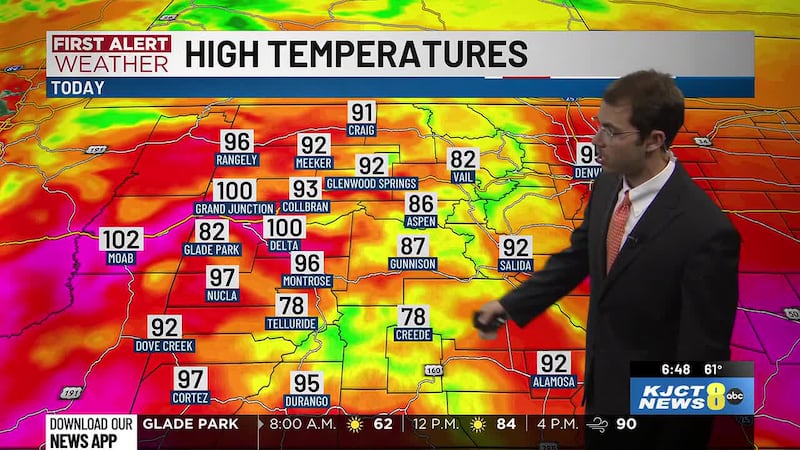
Friday’s Forecast
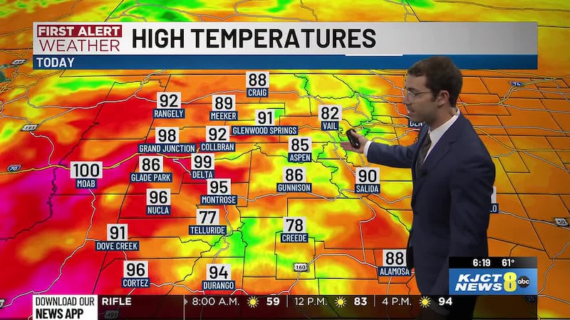
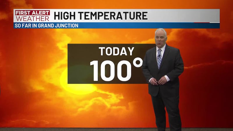
Friday will be sunny to mostly sunny. We’ll warm from low-to-mid 60s at 7 AM to mid-to-upper 80s at noon, then mid-to-upper 90s at 4 PM. High temperatures in the afternoon will be near 100 degrees around Grand Junction, 96 degrees around Montrose, 100 degrees around Delta, 95 degrees around Cortez, and 100 degrees around Moab. Low temperatures in the morning will be near 63 degrees around Grand Junction, 58 degrees around Montrose, 58 degrees around Delta, 53 degrees around Cortez, and 62 degrees around Moab.
Drought Monitor Update
The Drought Monitor continues to worsen across Colorado. Exceptional, extreme, and severe drought - the highest levels of drought - are widespread across nearly all of the state. Precipitation will be lacking, so no improvement is likely for at least the next two weeks. The opposite is more likely with the drought continuing to intensify.